
3D Laser Scanning & Model Extraction
Laser scanning records millions of measurements every second, creating detailed point clouds that accurately represent real-world conditions. NavVis for scale, terrestrial for precision.
Book A Meeting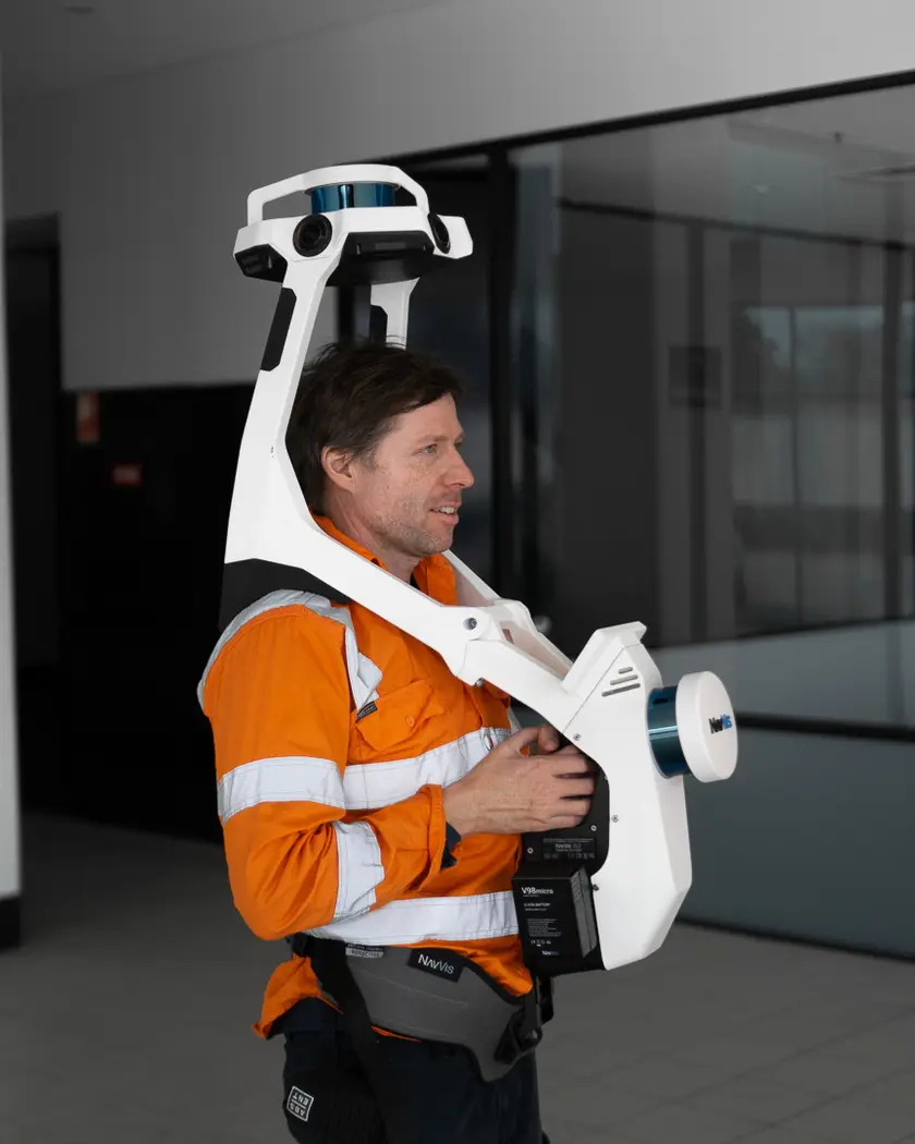
Record Everything, Decide Later
Conventional measurement captures the dimensions someone thought to take. Scanning records every visible surface within the scan area.
Missed Measurements
The dimension nobody took is always the one the design needs two months later, and it means another site visit.
Multiple Scanner Setups
Traditional terrestrial scanning needs many setups through a building, which makes large projects slow to capture.
Complex Architectural Detail
Facades, mouldings and irregular geometry cannot be usefully described by a handful of dimensions.
Point Cloud Files Nobody Can Open
A capture your project team cannot access without specialist software gets used once and then forgotten.
The Right Scanner for the Job
Two capture methods with genuinely different strengths, plus a platform to make the data usable.
NavVis Mobile Mapping
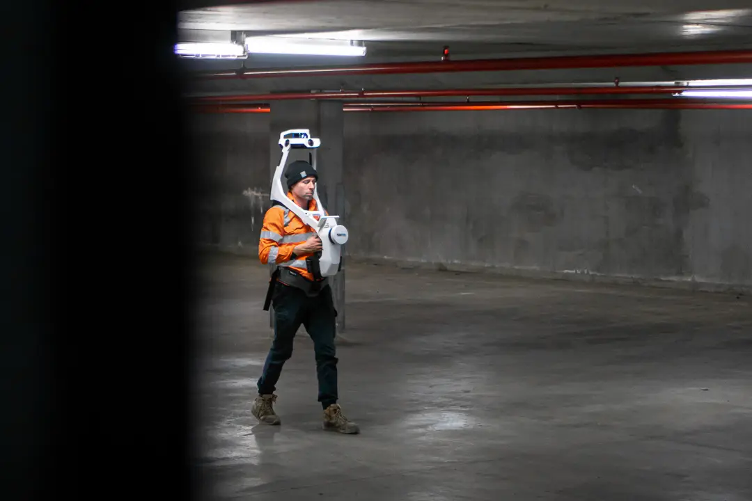
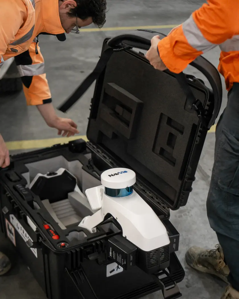
Surveyors walk naturally through a building while the system continuously captures high-density point cloud data and immersive 360 degree imagery, with significantly reduced field time.
Terrestrial Laser Scanning
Where the highest accuracy is required, survey-grade scanners capture millions of highly accurate measurements, recording every visible surface in the scan area.
Integrated With Survey Control
Terrestrial workflows tie into survey control to deliver millimetre accurate data for documentation, design, verification and heritage recording.
iVION Cloud Digital Twin
Reality capture data becomes an intuitive cloud-based digital twin accessible from anywhere through a web interface.
Deliverables
Processed using registration software and AI-assisted extraction tools, customised to each project.
Point Clouds and Models
Registered point clouds, Revit and BIM models, digital twins and clash detection models.
Drawings and Documentation
CAD drawings, as-constructed documentation, feature extraction and customised datasets.
Where It Suits Best
Hospitals, universities, commercial buildings, industrial facilities and warehouses, where speed of capture and minimal disruption are essential.
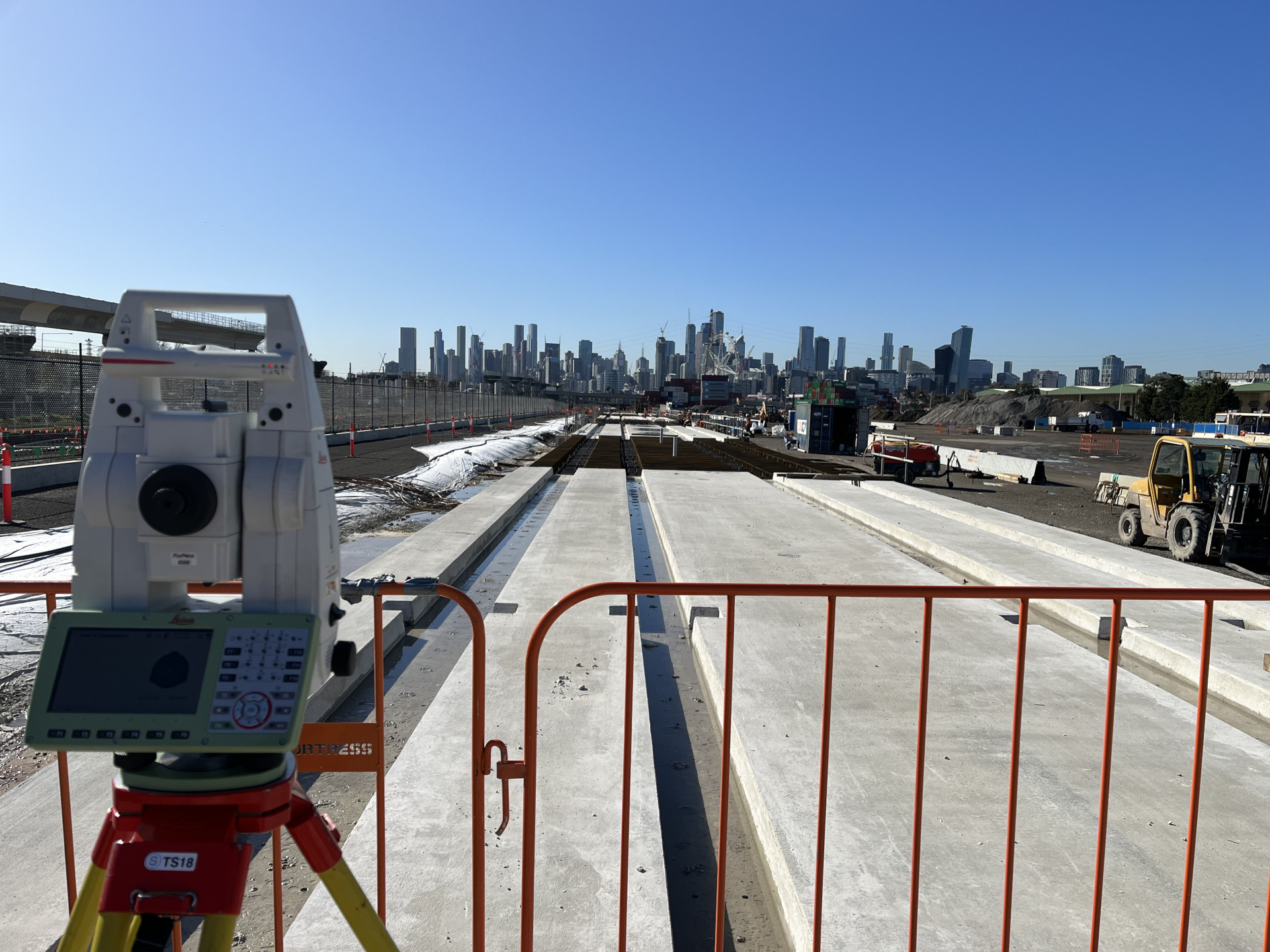
3D Laser Scanning Across Victoria
What Laser Scanning Does
Laser scanning is one of the most accurate and efficient methods available for capturing existing buildings, infrastructure and construction sites.
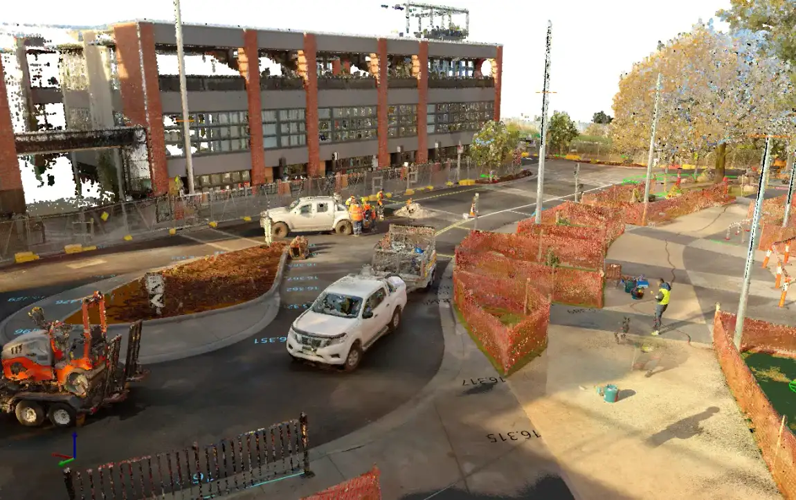
By recording millions of measurements every second, scanners create highly detailed three-dimensional point clouds that accurately represent real-world conditions. Captured data is processed using registration software and AI-assisted extraction tools to generate accurate digital deliverables.
NavVis Mobile Mapping
Traditional terrestrial scanning often requires multiple scanner setups throughout a building, which makes large projects time consuming to capture.
Our NavVis mobile mapping system streamlines that. Surveyors walk naturally through the building while it continuously captures high-density point cloud data and immersive 360 degree imagery, producing a fast, accurate and comprehensive digital record with significantly reduced field time. It suits large and complex environments such as hospitals, universities, commercial buildings, industrial facilities and warehouses, where speed and minimal disruption matter most.
Terrestrial Scanning for Precision
When the highest level of accuracy is required, terrestrial laser scanning remains the benchmark for reality capture. Survey-grade scanners capture millions of highly accurate three-dimensional measurements of buildings and structures.
Unlike conventional measuring methods, it records every visible surface within the scan area, providing a permanent digital record that can be revisited long after the site visit. That enables precise extraction of dimensions, elevations, sections, facades and complex architectural details while significantly reducing missed measurements and repeat visits.
Integrated with survey control, our terrestrial workflows deliver millimetre accurate data for architectural documentation, engineering design, construction verification, heritage recording and high-precision as-constructed surveys.
iVION Viewer
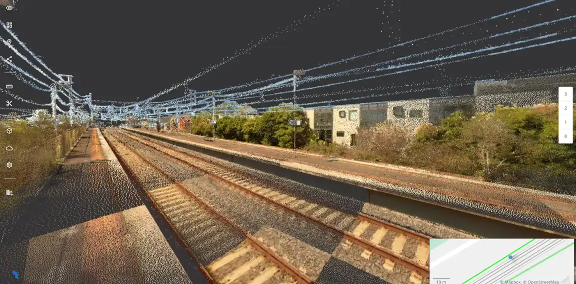
iVION transforms reality capture data into an intuitive, cloud-based digital twin that can be accessed from anywhere. Rather than navigating large point cloud files in specialist software, users explore the site through an interactive web interface, take measurements, annotate locations, review 360 degree imagery and collaborate with the project team in real time.
For architects, engineers, asset managers and facility owners that means remote inspection, fewer unnecessary site visits, and a single source of truth for planning, maintenance and future development.
What We Deliver
We provide registered point clouds, CAD drawings, Revit and BIM models, digital twins, clash detection models, as-constructed documentation, feature extraction and customised datasets to suit each project's requirements.
Learn more about architectural measurement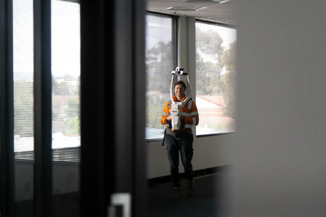
Laser Scanning Questions
It depends on the size and complexity of what is being scanned and what you want extracted. The capture itself is fast, so scanning is often cheaper than people expect. Extracting a full Revit or BIM model costs more than supplying the registered point cloud, because that is where the labour sits. We quote both so you can choose.
NavVis is mobile. A surveyor walks the building while it captures continuously, which is dramatically faster on large facilities. Terrestrial scanning uses fixed setups and remains the benchmark where the highest accuracy is required. We pick based on the building and the tolerance, and sometimes use both.
Very little. Scanners record millions of measurements a second and NavVis captures while walking at normal pace, so visits usually run to hours rather than days and most facilities keep operating around us.
Yes. iVION turns the capture into a cloud-based digital twin accessible through a web browser, where you can take measurements, annotate locations and review 360 degree imagery without installing point cloud software.
Registered point clouds, CAD drawings, Revit and BIM models, digital twins, clash detection models, as-constructed documentation and customised datasets matched to your project's requirements.
Yes. We work across metro Melbourne, South West Victoria and Gippsland. A single comprehensive capture is particularly valuable on regional buildings where repeat visits are expensive.
Trusted By Businesses Across Australia
- Luke Vearing Construction Manager at Speedpro Civil
Speedpro has had the pleasure of working alongside Outright Surveying for over 10 years, and we are always thoroughly impressed with their level of expertise, professionalism, accuracy, and reliability.
- Rowan Bird Project Survey Manager at Seymour Whyte
I’ve been working with Outright Surveying on several projects. The team consistently deliver with reliable and easy to deal with Surveyors, making the projects run smoothly.
- Nevil Sabu Alex Construction Manager at John Holland
Outright Surveying has been my trusty surveying partner for close to a decade. The service I have received from their surveyors and management team has been second to none.

Start Your Project With Confidence
Infrastructure surveys, building setouts, 3D scanning, aerial mapping and more. Our experienced team is ready to help. Tell us about your requirements and we'll respond as soon as possible.
- Phone 0400 751 199
- Address 4/20 Duerdin St, Clayton
Melbourne
- Phone 0413 147 976
- Location South West Regional Victoria