
Architectural Measurement
Existing buildings captured in full rather than measured by tape. Millions of survey points in one short visit, extracted into the floor plans, elevations, sections and models your documentation needs.
Book A Meeting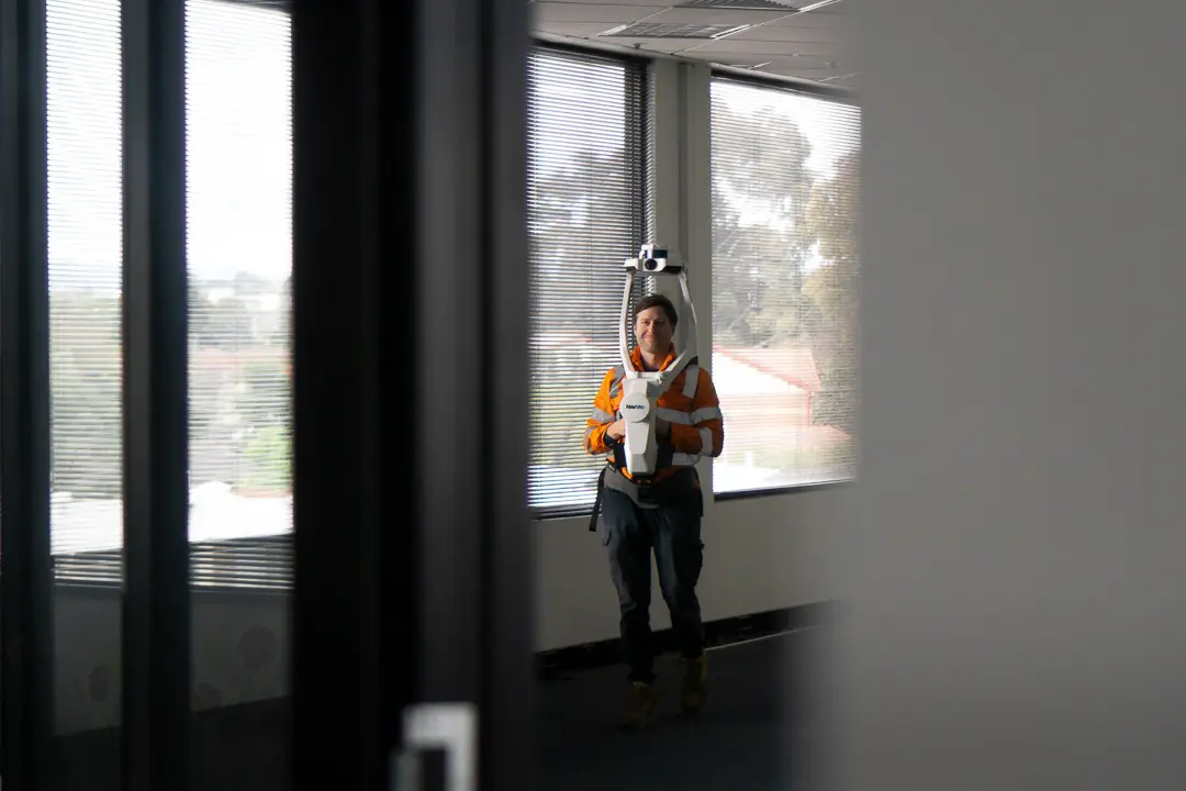
Measured Up by Tape, Twice
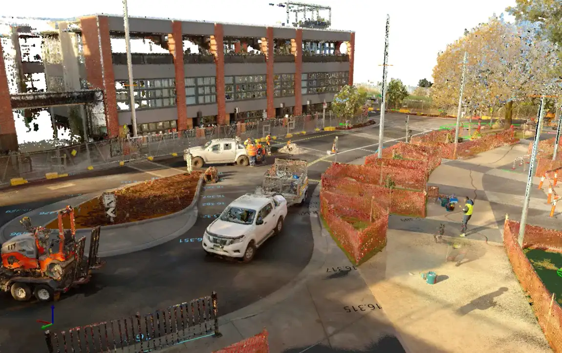
Conventional measure-ups are labour intensive, disruptive and prone to omissions, particularly on complex buildings.
The Missing Dimension
A tape survey records what someone thought to record. Two months into design, the one that matters is the one nobody took.
Original Drawings Are Wrong
On refurbishment and adaptive reuse the archive drawings are incomplete, or no longer reflect what was actually built.
Repeat Site Visits
Every gap in the data means another visit, another access arrangement and another interruption to whoever occupies the building.
Design Built on Assumption
Where information is missing, designers assume. Those assumptions surface as variations during construction.
Capture Once, Extract Later
Reality capture replaces conventional tape measurements with millions of accurate survey points, in a fraction of the time.
Scope the Capture
We confirm what the design requires and what level of detail the documentation needs before attending.
Capture On Site
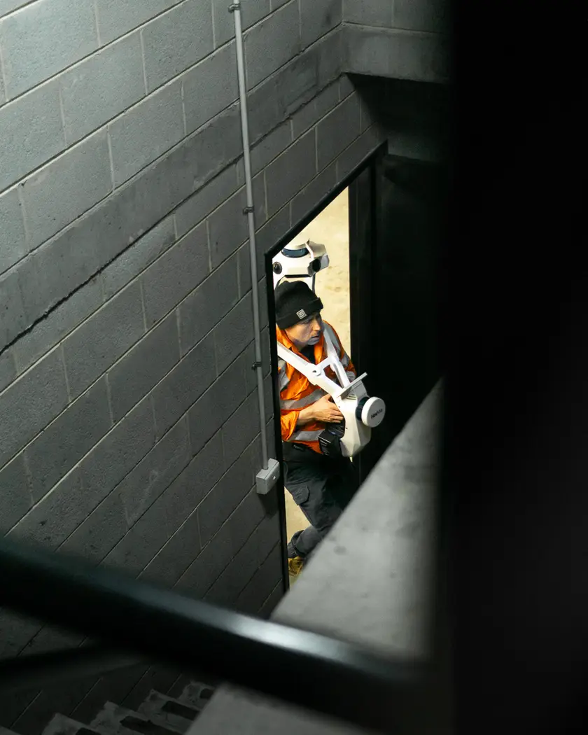
The building is scanned, creating a complete digital representation. Onsite time is short, which limits disruption to your operations.
Process in the Office
All data is processed remotely, using advanced processing software and AI-assisted extraction workflows.
Extract What You Need
The point cloud can be used directly, or we extract traditional 2D and 3D CAD outputs formatted exactly as your practice works.
Deliverables
Depending on the project requirements, we can provide the full range of measured building outputs.
Drawings
Floor plans, elevations, sections and reflected ceiling plans, delivered as CAD drawings suitable for design and documentation.
Models
3D models and Revit models built from the captured data rather than redrawn from an old set.
Point Clouds
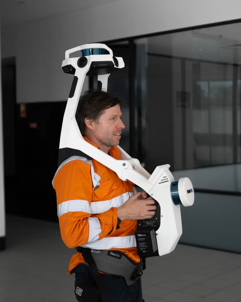
The registered point cloud itself, capturing all onsite elements so data can be extracted and formatted however you need it.
Measured Building Surveys Across Victoria
What Reality Capture Replaces
Traditional building measure-ups can be labour intensive, disruptive and prone to omissions, particularly on complex buildings.
Our reality capture technology replaces conventional tape measurements with millions of accurate survey points, creating a complete digital representation of the building in a fraction of the time. Onsite time is minimal and all data is processed and extracted in the office afterwards.
Why It Matters for Refurbishment
Accurate measurements of existing conditions reduce design assumptions, minimise costly site revisits and improve coordination between architects, engineers and contractors.
Reality capture is particularly valuable for refurbishment, renovation and adaptive reuse projects, where the original drawings are incomplete or no longer reflect the building as constructed. Working from a scan removes that entire category of risk.
Captured by People Who Have Built From Drawings
Our onsite survey team is also experienced in construction setout, so they understand which elements are important for design and how to capture and extract them to suit it.
That matters more than it sounds. A scan that technically covers the building but misses the detail a designer needs still results in another site visit.
How the Data Comes Out
The point cloud can be used directly by your design team, or we can extract traditional 2D or 3D CAD outputs using AI-assisted extraction tools.
Deliverables include floor plans, elevations, sections, reflected ceiling plans, point clouds, 3D models, Revit models and CAD drawings suitable for design and documentation. The 3D point cloud captures all elements onsite, which means we can extract and format the data exactly as you need it, including later when the brief changes.
Learn more about laser scanningLarger Buildings and Facilities
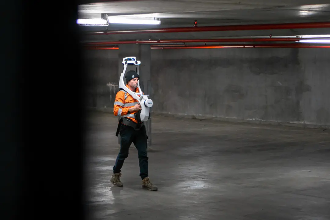
For hospitals, universities, industrial facilities and other large complex buildings, our NavVis mobile mapping system captures continuously while a surveyor walks the building, which cuts field time dramatically on projects that would otherwise need dozens of static setups.
Learn more about facility documentation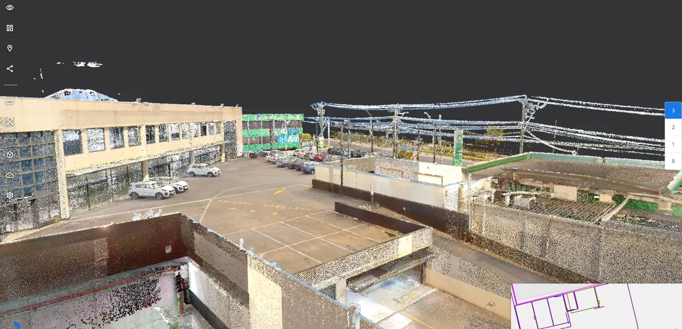
Measured Building Survey Questions
It scales with floor area, complexity and what you want extracted. The scan itself is fast, so a straightforward building is surprisingly affordable. Extracting a full Revit model costs more than supplying the point cloud, because that is where the labour is. Tell us the building and the deliverables and we will quote both options.
Usually hours rather than days. That is the point of reality capture. All processing happens in the office afterwards, so disruption to whoever occupies the building is limited to the capture itself.
The point cloud captures all visible elements, so in most cases we can extract it later without returning to site. That is the practical advantage over a tape survey, where anything not measured on the day means another visit.
Yes. We provide floor plans, elevations, sections, reflected ceiling plans, point clouds, 3D models, Revit models and CAD drawings, formatted for your documentation workflow.
Yes. Terrestrial laser scanning tied into survey control delivers millimetre-accurate data, which is the benchmark for architectural documentation and construction verification. For very large buildings we may combine it with mobile mapping and confirm the accuracy that suits your use.
Yes. We work across metro Melbourne, South West Victoria and Gippsland, and a single-visit capture is particularly worthwhile on regional buildings where repeat trips are expensive.
Trusted By Businesses Across Australia
- Luke Vearing Construction Manager at Speedpro Civil
Speedpro has had the pleasure of working alongside Outright Surveying for over 10 years, and we are always thoroughly impressed with their level of expertise, professionalism, accuracy, and reliability.
- Rowan Bird Project Survey Manager at Seymour Whyte
I’ve been working with Outright Surveying on several projects. The team consistently deliver with reliable and easy to deal with Surveyors, making the projects run smoothly.
- Nevil Sabu Alex Construction Manager at John Holland
Outright Surveying has been my trusty surveying partner for close to a decade. The service I have received from their surveyors and management team has been second to none.

Start Your Project With Confidence
Infrastructure surveys, building setouts, 3D scanning, aerial mapping and more. Our experienced team is ready to help. Tell us about your requirements and we'll respond as soon as possible.
- Phone 0400 751 199
- Address 4/20 Duerdin St, Clayton
Melbourne
- Phone 0413 147 976
- Location South West Regional Victoria